CPI has made many enhancements to AURIC since its inception, including a more comprehensive chemistry model (for neutral and ionospheric species), new radiative transfer capabilities, the option of performing photoelectron energy degradation with or without transport, updates to electron impact cross sections and the addition of new emission features. AURIC is currently in use by a number of organizations: The Naval Research Laboratory, Johns Hopkins Applied Physics Laboratory, Laboratory for Atmospheric and Space Physics (University of Colorado), Southwest Research Institute, and the Slovak Academy of Sciences. The most recent applications of AURIC have been for the Mars Atmosphere and Volatile EvolutioN (MAVEN) mission and the New Horizons encounter with the Pluto – Charon system. A summary of AURIC's modeling capabilities can be found in the AURIC brochure. Examples of applications papers using AURIC are listed in the references below.
AURIC has been validated against numerous published rocket and satellite data, and shown to have good overall agreement with the measurements. The airglow modeling capabilities of AURIC make it a powerful tool for characterizing optical backgrounds at thermospheric altitudes, for developing remote sensing algorithms, for simulating data from rocket and satellite optical instrumentation, and for conducting science investigations (both sensitivity studies and data analyses).
earth and planetary radiative transfer
The applications for atmospheric radiative transfer models are wide-ranging, including forward modeling of remote sensors, accurate retrieval of remotely-sensed information, calculation of parameters for atmospheric correction of remotely-sensed imagery, and support of synthetic scene generation. CPI has domain expertise in all of these areas and has developed mature models and software tools used by NASA, university and national labs, and private industry.
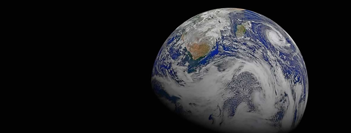
From the ocean to space, from Earth to Pluto, CPI's radiative transfer tools bring impressive clarity and innovation to scene generation, image correction and atmospheric modeling challenges. CPI's AURIC tool is proven reliable in DoD and NASA missions such as MSX, DMSP, TIMED, MAVEN, Cassini, Gold, and New Horizons.
Radiative Transfer Models
AURIC
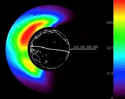
The Atmospheric Ultraviolet Radiance Integrated Code (AURIC) is a software package originally developed by Computational Physics, Inc. (CPI) for the Air Force Phillips Laboratory (currently the Air Force Research Laboratory [AFRL]) for upper atmospheric radiance modeling from the far ultraviolet to the near infrared. It effectively extends the MODTRAN® code for calculating atmospheric transmittance and radiance (infrared and Rayleigh plus aerosol scattering of sunlight) to earth altitudes above 100 km and wavelengths down to 80 nm.
More information
AETHER
The AETHER™ software product is a band-model atmospheric radiative transfer code developed from the Department of Defense standard model Moderate Spectral Atmospheric Radiance and Transmission (MOSART).
More information
AETHER™ solves the radiative transfer equation in a fully three-dimensional, spatially varying atmosphere, and outputs the full radiative environment for any spectral band in the ultraviolet through microwave spectral regions (0.2 μm to infinity, or 0-50,000 cm-1). AETHER™ uses the same molecular band model as MODTRAN® 5, derived from the HITRAN 2008 database, to provide spectral sampling options of 15 cm-1, 5 cm-1, 1 cm-1 and 0.1 cm-1. Radiative effects modeled include absorption, emission, reflection, transmission, single scattering, multiple scattering and turbulence. Multiple scattering is modeled using an exponential sum fit algorithm. Radiative outputs include path radiance, solar/lunar irradiance, skyshine, and transmission, all as a function of altitude. Terrain material temperatures for a large number of materials can also be calculated for the given atmospheric conditions. Environmental characterization is provided by an extensive set of global databases incorporated into the AETHER™ code, including terrain elevation, water/snow compositions, ecosystem type, soil types and properties, urban center locations and population densities, climatology atmospheric profiles from the Earth’s surface to the tropopause, and hydrology. AETHER™ provides 18 aerosol models and 23 model atmospheres with seasonal variations, and allows customization of these models through scalable profiles (water vapor, carbon dioxide, ozone, haze) and variable climatologies (temperature, humidity, wind). For cases where this is still not sufficient AETHER™ allows full customization through user-defined three-dimensional atmospheres. In addition, AETHER™ includes several cloud, rain and fog (hydrometeors) models which can be requested by the user. AETHER™ supports a wide variety of viewing geometries, including Earth-based, space-based and airborne. Multiple geometries can be included in a single execution of the code, each for a different time of day, making AETHER™ a fully four-dimensional code.
AETHER™ can be used for calculating accurate and realistic atmospheric transmission and radiance along sensor-target line-of-sight paths as well as calculating optical radiance backgrounds against which targets are detected by sensor systems. This provides the capability to support both scene and signature simulations. Currently CPI uses AETHER™ to support both the Atmospheric Correction Tool (ACT) prototype and the scene simulation models GAIA™ and OCEANUS™.
Scene Generation
GAIA
Global-scene Architecture for Integrated atmosphere, terrain, and cloud Analysis
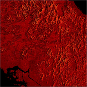
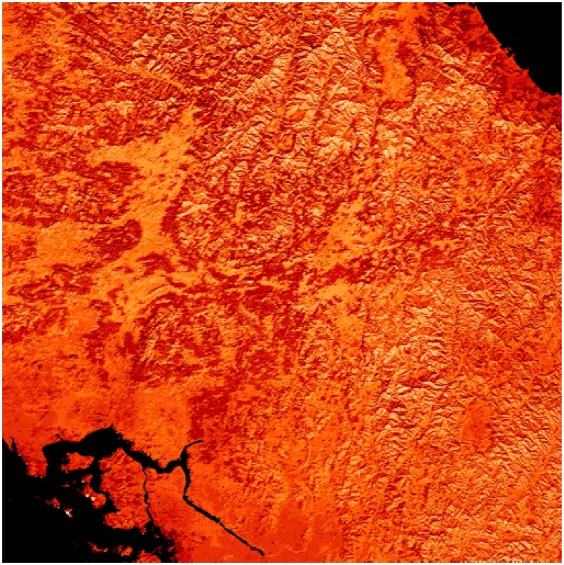
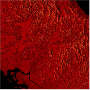
GAIA™ is a physics-based model for accurately and rapidly generating terrain and cloud imagery in the UV, visible and IR for any location on Earth at any time of year.
More information
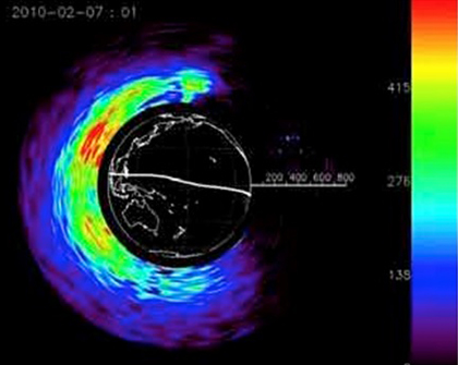
The terrain radiance maps generated by GAIA™ are radiometrically correct images as viewed from the front end of a sensor. GAIA™ creates a radiance field based on user input parameters such as latitude and longitude, viewing geometries, and time of year. Using large amounts of remotely sensed data, it accounts for land topography, vegetation material optical and thermal properties, terrain self shadowing, cloud shadowing, seasonal variations, and downwelled sky radiance due to scattering and emission as well as reflected and absorbed energy. This radiance field is then propagated back through the atmosphere where it is attenuated by scattering and absorption and where path radiance due to atmospheric scattering and emission is added. The result is a synthetic sensor-viewing scene which exhibits proper phenomenology for the given user inputs. Atmospheric effects are provided by the AETHER™ radiative transfer model. GAIA™ can calculate at-aperture radiance for any reasonable sensor geometry, including space-based, airborne and ground-based systems.
GAIA™ generates images for the full electromagnetic spectrum requiring it to trace the illuminating radiation path from its source (sun/moon) to the various objects in the scene. As shown above, the radiation is scattered, absorbed, or transmitted from the scene objects. Scene objects can include sand, vegetation, water bodies, snow, ice, clouds, asphalt, rock, gravel, metal, wood, fabric, and other man-made materials.
Our ocean model, OCEANUS™, has been integrated into GAIA™ to provide enhanced ocean scene capabilities for a scene generation model that covers the earth.
OCEANUS
Ocean Universal Scene
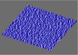
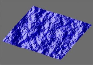
OCEANUS™ is a physics-based ocean background scene model for accurately calculating water-leaving radiance in the ultraviolet (UV), visible, and infrared (IR) portions of the spectrum (0.2 – 50 microns) as a function of time, location, and sea state. It calculates realistic wave structure consistent with surface wind for fully developed, partially developed, and swell sea states.
More information
OCEANUS™ is database driven, incorporating a large amount of remotely-sensed measured data. The data available includes monthly variations in the global sea surface temperature, the global sea surface salinity, the global sea ice, phytoplankton, CDOM, and suspended sediment distributions, global sea surface wind speed and direction, and ocean depth. This data characterizes the ocean spatially on a global scale for annual and multi-year cycles for local meteorological conditions, and accounts for the different ocean environments (e.g., open ocean, littoral, river mouths, estuaries). However, if desired the user can override these database values with customized inputs for a known ocean location.
OCEANUS™ is designed to incorporate all key ocean phenomena, including surface bidirectional reflectivity and directional emissivity from the ocean surface, multiple scattering within the ocean volume, and reflections from the ocean floor (important for visible wavelengths in the littoral zone). Both static and time-dependent ocean surface wave structure can be calculated based on local conditions such as surface wind speed and ocean depth. This pixel dependent surface orientation is important for calculating the bidirectional reflectivity and directional emissivity. Atmospheric effects and radiance values to support scene simulation are provided by the AETHER™ radiative transfer model. This includes atmospheric transmission, path radiance, incident direct diffuse solar irradiance, incident direct and diffuse lunar irradiance, and incident diffuse thermal irradiance, all on a three-dimensional grid (latitude, longitude and altitude).
OCEANUS™ has been integrated into GAIA™ for generating unified ocean and terrain scenes.